For many ag-stakeholders, keeping full track of what’s going on in the field is a major challenge. This is the case for ag buyers, government agencies and NGOs, ag insurers and creditors – especially those working over with many growers over a large area. The traditional method for dealing with this challenge involves sending people to visit the field, monitor progress, and file reports (with no access to remote sensing data in agriculture). While still necessary, this approach is costly and time-consuming, and in the age of COVID-19, it is often not feasible.
Fortunately, the welcomed disruption of agriculture technologies (or AgTech, as many like to call them) includes remote sensing solutions that use satellite data to monitor progress at a fraction of the cost. Several advancements have been made particularly for field crops. Information gathered is utilized for crop type identification, planting date and progress tracking, field size measuring, crop health assessment, benchmarking the performance of growers and plots, and more. It complements other data sources already used in the existing operations for many ag-stakeholders, and in some cases recently, the only source of data available.
The transition to advanced remote sensing was made possible thanks to several factors, but broadly speaking:
- High-resolution data became available for a relatively low cost (sometimes at no cost at all, as in the case of public satellites);
- The greater availability of field data due to the digitization trend in the agriculture industry, which can be used to improve prediction from the remote sensing-based models; and
- The growing use of data science in a wide variety of industries, which has further improved modelling capabilities.
At Agritask, we are uniquely qualified to provide remote sensing solutions given the wealth of ground data at our disposal and our deep understanding of agronomy for the multiple crops and regions that we operate in. Most importantly, we provide an operations platform that translates the insights generated into actionable items.
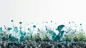
Remote sensing gives insights into the entire crop cycle
We mention below a few of our remote sensing capabilities that received a number of inquiries recently.
- Planting analysis. With just one GPS point, one can now know crop types, plot boundaries, the size of the cultivated areas, and estimated planting dates. This helps establish, for example, whether the reported crops were planted, and whether it was done within the agreed-upon planting window.
- Crop health. For field crops, the most commonly used index for crop monitoring is the Normalized Difference Vegetation Index (NDVI), sensitive to both biomass and chlorophyll activity. Another common index is the Normalized Difference Water Index (NDWI), estimating the leaf water content at the canopy level. Such information is commonly used to track crop health status and water stress levels through the season.
- Operational and environmental risk rating. We have a proprietary risk classification methodology that enables growers and stakeholders to assess risk factors that can affect the productivity of each plot, which may include operational quality or environmental issues such as soil fertility, weather, and others.
- Yield indication and benchmarking capabilities. Our solutions assign a proprietary Yield Potential Index to each plot, enabling users to compare different plots on a regional scale as well as have indications of yield potential at the end of the season. Growers can optimize growth and detect issues affecting specific plots, while aggregates can differentiate strong and weak areas, and focus their attention accordingly.
Remote sensing offers unique benefits to each of the various ag-stakeholders
- Corporate growers: Having to manage large areas and often in multiple locations, corporate growers seek information to optimize their operations. Even if they already monitor the field using their workforce and other technologies, an additional point of reference is often welcomed, especially one that is not prone to human errors and cost-effective.
- Ag buyers: The ability to estimate harvest quantity and timing means a great deal for buyers, who can better plan for the future based on the anticipated yield. In addition, buyers can collaborate with growers better using updated information that previously required frequent visits to the field.
- Farm input companies: Companies working closely with growers to provide seeds, fertilizers and chemicals gain a deeper understanding of their growers and improve their interactions accordingly. Moreover, they may also identify new business opportunities with existing or potential customers based on remote sensing data.
- Government agencies and NGOs: Satellite-based remote sensing is highly scalable to cover a very large area – even the whole country. Remote sensing data provides the big picture regarding trends or patterns that allow governments and NGOs to allocate their support more appropriately, as well as greater insights into specific parts of the area they operate in.
- Ag insurers and creditors: Remote sensing data can be useful through the product life cycle, starting from compliance to underwriting and ongoing monitoring. Insurers and creditors can check if growers indeed grow the reported crops in the plots and time windows specified. The ability to have indications of yield potential and benchmark different plots in the same region will help with managing risk in agriculture, pricing, and more.
A note on high-resolution imagery
Satellite observation technology like Sentinel-2 covers many use cases – but it still isn’t perfect. Different natural conditions such as clouds may negatively affect visibility, and resolution might be insufficient for capturing certain details, like differentiating between crop and weed or population counting.
High-resolution imagery can significantly reduce these issues by providing a solid alternative in such cases and is now more available and cost-friendly than ever before. It is offered by low orbit satellites, planes, UAVs, and more.

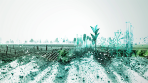
Connecting the sky to the ground
At Agritask, we believe in bringing in all relevant data together for holistic decisions and better making. We do not suggest remote sensing can eliminate the need for other sources of data from the ground – may it be from field scouting, sensors, or others. Quite the contrary, combining it will create greater and actionable insights.
On-ground data is still required for validating and calibrating the remote-sensing based models, especially for new crops and geographies. In addition, to pinpoint specific problems, some level of ground operations is also necessary. For example, satellite data may indicate which areas of the field suffer from high production risk, then growers can plan specific action plans to identify specific issues, such as pest and disease or others;
Most importantly, after discovering that there are certain problems affecting the field, you still need to plan and execute the solutions. This requires a comprehensive platform such as Agritask that enables planning, task assignment, and follow-up using intuitive visualization of all relevant data.
Much like different procedures in nature, it takes an entire ecosystem of participants and solutions to generate growth. With dedicated, in-house experts in agronomy, GIS, and remote sensing, Agritask captures and analyzes data and transforms it into actionable insights. Our mantra remains “one platform, one database”, enabling farmers and other players in the industry to manage all of their data in one trustworthy place. By connecting all the dots and analyzing multiple sources of information, we are able to offer the agriculture industry new tools and methods that will help it blossom in full force.